Your shopping cart


GARMIN INREACH EXPLORER +
- Regular price
- €399,00
- Sale price
- €399,00
- Regular price
-
€499,00 - Unit price
- per
Couldn't load pickup availability
Dimensions
Dimensions
Share


Anche nei luoghi più remoti sarai sempre raggiungibile finché avrai al tuo fianco inReach Explorer+. Questi comunicatori satellitari portatili sono progettati per gli amanti dell'outdoor che desiderano esplorare gli angoli più remoti del pianeta e avventurarsi in luoghi sconosciuti senza compromettere la propria tranquillità e quella dei loro cari. In qualsiasi punto del mondo, inReach fornisce comunicazione, condivisione della posizione, navigazione GPS e garanzia di sicurezza, tutti aspetti importanti per chiunque desideri avventurarsi anche là dove solo i più temerari osano.
Con la copertura mondiale della rete satellitare Iridium, questi dispositivi portatili consentono di inviare e ricevere messaggi di testo a qualsiasi numero di telefono cellulare o indirizzo e-mail e al contempo utilizzare il GPS per tracciare e condividere i propri progressi del viaggio. È possibile pubblicare sui social media o comunicare tra dispositivi inReach anche quando ci si trova sul campo.
In caso di emergenza puoi utilizzare inReach per inviare una richiesta di soccorso al centro di monitoraggio 24/7, inviare e rispondere a messaggi sulla natura dell'emergenza e ricevere conferma dagli operatori quando i soccorsi si sono attivati.
Quando viaggi all'estero sono molte le cose a cui devi pensare affinché il tuo viaggio possa trasformarsi in una grande avventura. Sapere di poter disporre di copertura costante, di poter parlare con familiari e amici o di poter chiamare i soccorsi conoscendo esattamente i costi associati grazie ai piani di servizio inReach, ti permette di viaggiare con la consapevolezza di non essere mai solo, libero di esplorare anche i confini del mondo.
GEOS è leader mondiale nella gestione delle emergenze, ha organizzato soccorsi in oltre 140 paesi, salvando migliaia di vite. È sempre pronto 24/7/365 a rispondere al tuo SOS, tracciare il tuo dispositivo, avvisare i contatti appropriati e gli operatori di ricerca e soccorso nella tua area. Una volta partiti i soccorsi, GEOS continua a comunicare con te tramite un servizio di messaggistica bidirezionale, fornendoti aggiornamenti e informazioni vitali finché la situazione non si è risolta.
Piani di trasmissione satellitare economici e flessibili.
Per accedere alla rete Iridium e comunicare con il dispositivo inReach SE+ o Explorer+ è necessario attivare un abbonamento satellitare. A seconda dell'utilizzo è possibile scegliere tra un piano a contratto della durata di un anno, più conveniente, o un piano mensile, più flessibile.
Specifiche:
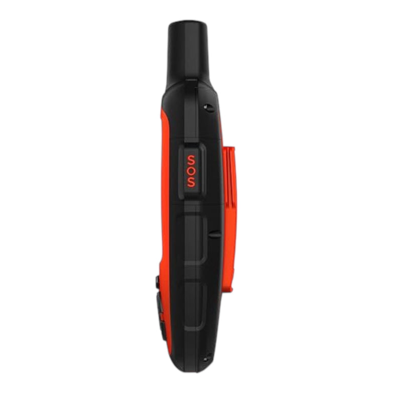
| Dimensioni | 6,8 x 16,4 x 3,8 cm con tastiera e pulsante SOS |
|---|---|
| Peso |
213.0 g |
| Classificazione di impermeabilità | IPX7 |
| Tipo di schermo | TFT transflettivo a colori |
| Dimensioni del display | 3,5 x 4,7 cm; 2,31" diagonale (5,9 cm) |
| Risoluzione del display | 200 x 265 pixel |
| Tipo di batteria | Agli ioni di litio ricaricabile |
| Durata della batteria | Fino a 100 ore in modalità di rilevamento ogni 10 minuti (impostazione predefinita); e fino a 3 anni in modalità di sospensione. |
| Memoria/cronologia | 2 GB |
| Interfaccia | micro USB |
Mappe e memoria |
|
| Cartografia precaricata |
Sì (OSM) |
|---|---|
| Cartografia aggiuntiva | |
| Basemap mondiale | |
| Include informazioni idrografiche dettagliate (linee costiere, sponde di fiumi/laghi, paludi e corsi d'acqua perenni e stagionali) | |
| Consente di visualizzare parchi nazionali, statali e locali, foreste e riserve naturali | |
| Posizioni memorizzabili | 500 |
| Tracce | single dynamic track |
| Registro tracce | single auto overwrite track log |
| Percorsi memorizzabili | 20, 200 points per route |
Sensori |
|
| GPS | |
|---|---|
| Altimetro barometrico | |
| Bussola | Sì (con compensazione inclinazione, 3 assi) |
| Ricevitore GPS ad alta sensibilità | |
| Bussola GPS (in movimento) | |
Funzioni per l'Outdoor |
|
| Fotocamera |
No |
|---|---|
Funzionalità inReach® |
|
| SOS interattivo | |
|---|---|
| Invia e ricevi messaggi di testo a SMS e indirizzi e-mail | |
| Invia e ricevi messaggi di testo ad altri dispositivi inReach | |
| Scambia le posizioni con altri dispositivi inReach | |
| MapShare compatibile con il rilevamento | |
| Tastiera virtuale per i messaggi personalizzati | |
| Invia waypoint a MapShare durante il viaggio | |
| Invia selezione dei percorsi a MapShare durante il viaggio | |
Applicazioni esterne |
|
| Compatibile con Earthmate | |
|---|---|
| Compatibile con il sito Web Garmin Explore | |
Connessioni |
|
| Connettività wireless |
yes (BLUETOOTH®) |
|---|---|
Caratteristiche aggiuntive |
|
| Caratteristiche aggiuntive |
|
|---|---|